
Rock Island ZIP Coverage
Official sources support one primary Rock Island city association and two added routing associations that need address-level checks. They also publish county-wide and Census lists that must not be treated as a city roster. The Rock Island ZIP code directory therefore labels the strength of each link instead of claiming a clean municipal boundary. Use the source and note columns together.
| Postal Code | Areas Covered | Post Office | Notes |
|---|---|---|---|
| 61201 | Primary Rock Island city association, including the downtown and central city context | Downtown Rock Island location | USPS shows Rock Island, IL 61201-9998; verify each address |
| 61204 | Rock Island postal-routing association | USPS Postal Bulletin association | Exact delivery area and special-route status were not confirmed |
| 61299 | Rock Island postal-routing association | USPS Postal Bulletin and older DMM listing | Do not assume every address lies within city limits |
| 61236, 61239, 61259, 61265, 61279 | Places in a Rock Island County-wide IDPH ZIP list | Postal offices vary | County association is not proof of City of Rock Island service |
| 61264, 61265, 61284 | Nearby or intersecting Census statistical areas | Not established by this source | ZCTA context, not a confirmed postal city list |
The source set did not establish a city-specific ZIP split, a realignment year, a PO-box-only list, or a unique institution assignment. That gap matters. The 61204 and 61299 links are routing associations, not permission to invent delivery boundaries. A valid Rock Island postal result still needs the USPS address tool when the exact street is known.
Rock Island ZIP 61201
The strongest postal association is 61201. The Downtown Rock Island Post Office listing displays Rock Island, Illinois 61201-9998. That confirms the office and primary label, but it does not draw a municipal boundary around every delivery point. The Census also publishes a 61201 ZCTA, which is useful for statistics but is not the USPS route itself.
The manifest includes a successful view of that official post-office listing:
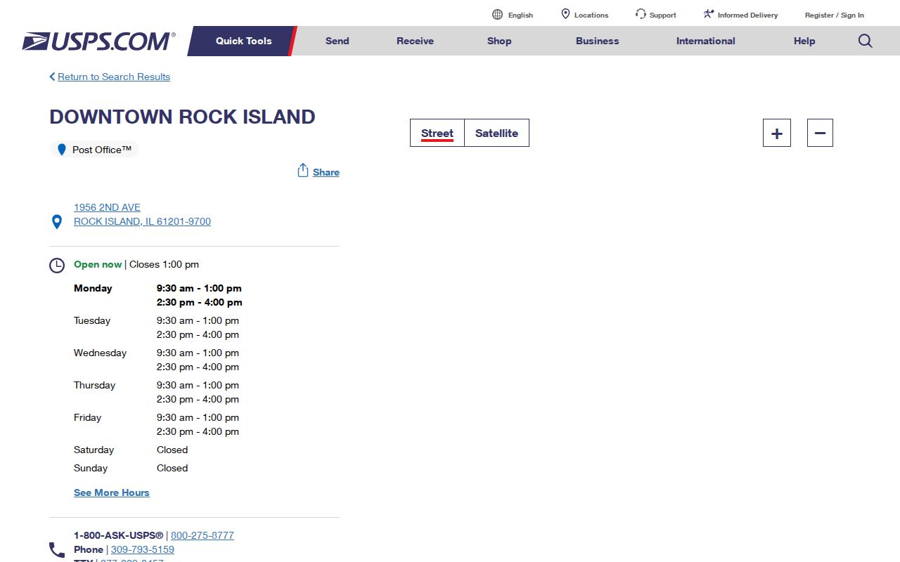
The office result confirms a postal association. County GIS remains the better tool for a parcel, jurisdiction, precinct, or city-limit question.
Rock Island Routing Associations
USPS Postal Bulletin label and container material associates 61204 and 61299 with the Rock Island 61201 label. The inspected material did not expose the exact street-level delivery geography or prove that either code is PO-box-only or unique. Those claims should not appear in a search result without live USPS verification.
This is a useful Rock Island ZIP code directory quirk. A routing association can exist for mail operations while a parcel belongs to another civic area. Search the complete address, not the code alone. If the address is historical, test the old city name Stephenson for records from 1835 through 1841, then bridge the old street description to a modern parcel or legal description.
County ZIPs Are Not City ZIPs
Rock Island County spans far more ground than the City of Rock Island. An Illinois Department of Public Health county list includes 61236, 61239, 61259, 61265, and 61279. That county-wide table supports county context only. It does not prove that these codes serve addresses inside Rock Island's municipal line.
Census displays add nearby or intersecting ZCTAs such as 61264, 61265, and 61284 around the city profile. A ZCTA is a statistical shape built for Census tabulation. It can help compare population data, yet it does not certify mail service. Keeping the city, county, and statistical sets separate prevents a ZIP search from sweeping in unrelated residents.
Boundary check. A Rock Island mailing label can fall outside the city, while a city parcel can use a neighboring postal route.
Rock Island ZIP Search Fields
Local tools handle postal information in different ways. The voter form makes a five-digit code a gate for one person's address. GIS stores ZIP values on parcels, address points, and the left or right side of street segments. The assessor offers city and street criteria, but research did not find a promised ZIP-wide export. USPS supplies the delivery answer for a specific address.
| Local tool | ZIP field or mode | What it returns | Limit |
|---|---|---|---|
| Illinois voter lookup | Required Five Digit Zipcode | Reveals street number and street-name controls for one person | Not a ZIP resident roster |
| County GIS | Site_zip, prp_zip, zipl, zipr | Mapped parcel, address-point, and street values | GIS attributes do not certify USPS delivery |
| Assessor wEdge | Address city and street; no explicit ZIP field observed | Individual parcel and tax-year results | Do not promise a ZIP owner export |
| USPS lookup | Address-based verification | Delivery city, state, and code | Interactive result fields were not captured |
| Census ZCTA | Statistical geography | Population data for the ZCTA | Not a postal or city boundary |
This field-level contrast is why a code alone cannot confirm a Rock Island resident. Match the tool to the question. If the GIS point and USPS result differ, save both results with their dates and ask the office that owns the disputed field. County GIS staff maintain parcel and E911 address layers, while USPS controls postal routing. The Elections office can explain why a valid ZIP reveals certain street choices in the registration form. Each custodian can correct its own data, but one cannot rewrite the other's system.
Find Rock Island Residents by ZIP
Begin with a full street address whenever possible. Postal and parcel tools can place that address, while the state voter form can test one known person's registration. None offers a lawful open list of everyone in one code. Use this sequence to narrow a Rock Island postal area without confusing route data with resident proof:
- Enter the complete address in the USPS Address Lookup. Copy the returned delivery city, state, and five-digit code.
- Search the county GIS by address. Compare the address point, parcel ZIP, jurisdiction, precinct, and street-side ZIP values.
- Use wEdge by street address, owner name, or PIN when a property record is relevant. Treat the mailing address and situs as separate fields.
- Use Illinois Registration Lookup only for a known person, with name, birth date, five-digit ZIP, street number, and street name.
- Check the date and source of each result. Postal and county datasets can change on different schedules.
Once a verified code narrows the area, the Rock Island street directory is the better place for street-level parcel work. A code is too broad to stand in for an address chain.
Verify ZIP, Then Map Rock Island
The strongest workflow joins two official systems. USPS answers how a specific address is routed for delivery. Rock Island County GIS answers where the address point and parcel sit among municipal, precinct, zoning, floodplain, and other mapped layers. The systems can disagree in appearance because they were built for different tasks.
The manifest's successful capture links to the official USPS address and ZIP lookup:
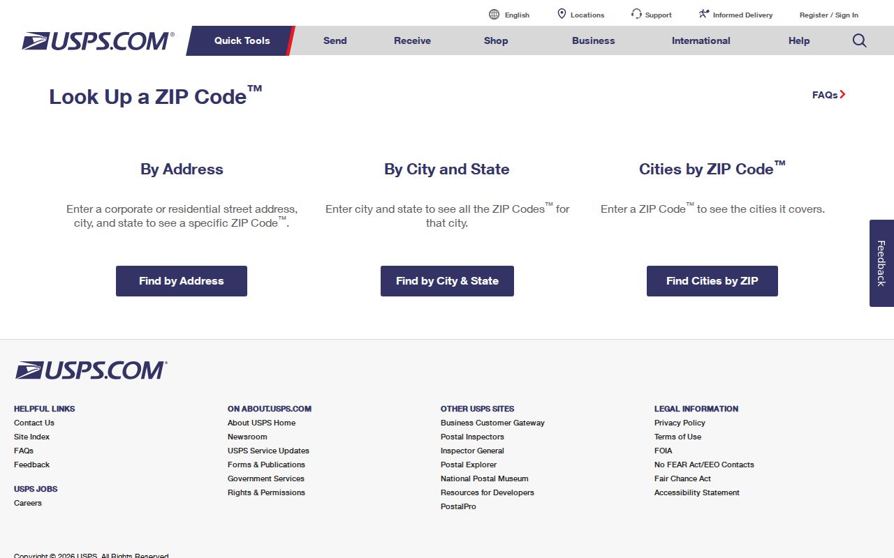
After the postal result, GIS can test the site's parcel and civic context. The county maintains more than 65,000 parcel boundaries plus street centerlines and E911 address data, but its ZIP attributes are still not a USPS legal boundary.
Four Rock Island Address Keys
A Rock Island postal code is only one part of an address identity. Public records may use the physical site, the tax-bill destination, or the land description instead. Keeping those fields apart is vital when a parcel owner receives mail elsewhere or when an old street address has changed.
- Situs address
- The physical location of the parcel or structure used by GIS and the assessor.
- Mailing address
- The place where tax or other mail is sent; it may be outside Rock Island.
- Legal description
- The lot, block, subdivision, or metes-and-bounds wording that identifies land.
- Postal ZIP
- The code used to route mail; it does not establish title, city jurisdiction, precinct, or occupancy.
For an old record, use the legal description and nearby cross streets to bridge it to the modern GIS address point. No official citywide street-renumbering year was found, so do not assume a number changed on a set date.
Rock Island ZIP and City Limits
A ZIP boundary is not a municipal boundary. Mail routes can cross a city line, and Census ZCTAs approximate postal patterns for statistics rather than delivery. County assessor and archive results also cover a much wider area than the city. When a search returns a Rock Island label, confirm the parcel jurisdiction in GIS before describing that person or property as inside the City of Rock Island.
Historic records add another mismatch. The county seat sequence includes Farnhamsburg, Stephenson, and Rock Island, while old directories and maps predate modern codes. Pair the historical name and street with a deed legal description, directory cross street, or Sanborn sheet. Assign a current code only after verifying the modern address.
- ZIP vs ZIP+4
- A five-digit delivery area versus a more exact nine-digit routing code.
- PO-box ZIP
- A code assigned chiefly for post-office box delivery.
- Unique ZIP
- A code assigned to one high-volume organization rather than a broad area.
- Carrier route
- A set of addresses served in one postal delivery sequence.
Research did not confirm that 61204 or 61299 is a PO-box or unique code. Those terms explain postal categories; they do not label an unverified Rock Island route.